How Hot is the Lava?

Thermal images of the small lava lake at the northeastern edge of the crater floor in Puʻu ʻŌʻō (Kilauea Volcano). The view in the top image is to the northeast; the view in the bottom image is to southeast. The lava lake is about 20 m (65 ft) across. (Hawaiian Volcano Observatory, USGS)

Thermal images of the Peace Day flow (episode 61) on the coastal plain. The bright areas show active flows, while the darker purple areas show the warm but inactive part of the flow. The top image looks northwest; the bottom image looks north. The terminus of the flow was about 175 m (575 ft) from the ocean. (Hawaiian Volcano Observatory, USGS)

Thermal image panorama showing the Peace Day flow (episode 61) on the coastal plain. The view is to the southwest. The bright areas are active lava, while the less bright areas are warm but inactive flows. (Hawaiian Volcano Observatory, USGS)
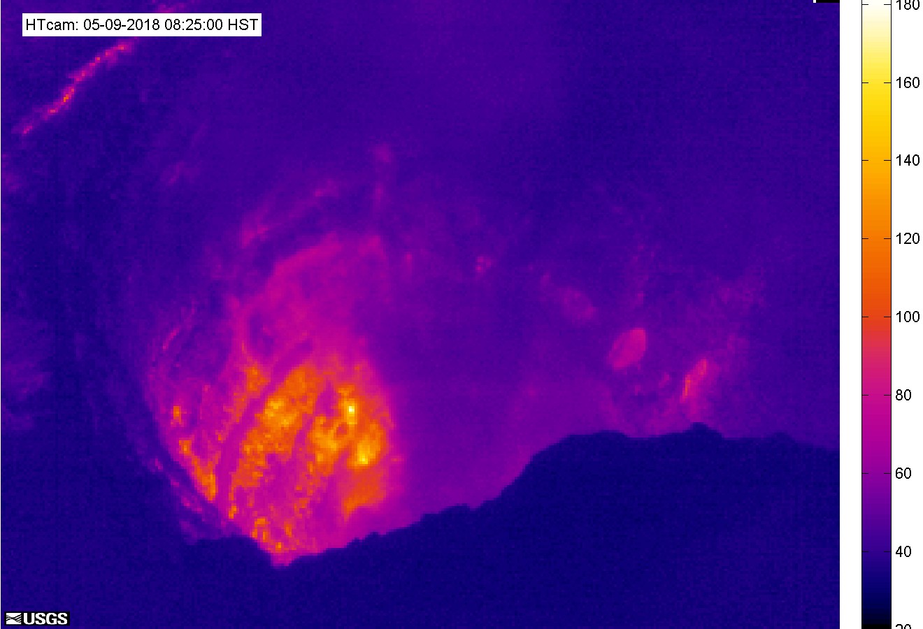
This is the most recent image from a temporary thermal camera. The temperature scale is in degrees Celsius up to a maximum of 500 Celsius (932 Fahrenheit) for this camera model, and scales based on the maximum and minimum temperatures within the frame. Thick fume, image pixel size and other factors often result in image temperatures being lower than actual surface temperatures. (Hawaiian Volcano Observatory, USGS)


aloha As usual interestiing info & great pix. Mahalo hb
WHOA! i live in Kapoho now, it’s neat to see it when it was actually a vilglae (now it’s a small residential subdivision) Pele just started a new show about 13 miles from my house certainly nothing this dramatic, but lava is always awe inspiring!